
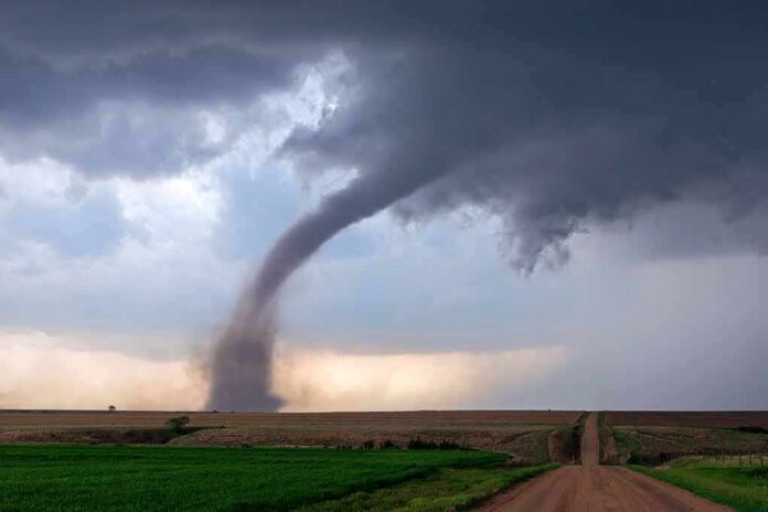
The double tornado filmed over fields and lakes near Grästorp is not just a striking clip in a news feed; it is a textbook case of how a very rare phenomenon plays out in a country where tornadoes are almost never seen, and how modern cameras are reshaping our understanding of severe weather in high latitudes.
Key Points
- A simultaneous pair of tornadoes was captured on video near Grästorp in western Sweden, moving over lakes and farmland before merging into a single, larger vortex.
- The event was witnessed from the ground and distributed globally via the Associated Press, making it one of Sweden’s most widely seen tornado episodes.
- Meteorologists and local observers agree that such double tornadoes are extraordinarily unusual in Sweden’s climate, where tornadoes of any kind are rare.
- The Grästorp footage slots into a small but growing record of Scandinavian tornadoes and reflects broader questions about how we classify and talk about “rare” severe weather.
A rare atmospheric “dance” over western Sweden
On a July morning near Grästorp, a locality west of Sweden’s largest lake Vänern, residents looking out across the lakes and surrounding fields saw something almost no one in the country ever witnesses first-hand: two fully developed tornado funnels on the ground at the same time. The video, shot from a vantage point overlooking the water and farmland, shows a matched pair of slender columns of rotating air moving in rough parallel, their bases obscured at times by heavy rain but their vortices clearly defined against low clouds.
Accounts in Spanish and Swedish-language media describe the scene as both fascinating and unsettling: the twin funnels persist for roughly a quarter of an hour as the parent storm passes the observer’s position, shifting slightly relative to one another before eventually merging into a single, broader tornado that weakens and dissipates. That merger—two visible vortices consolidating into one larger circulation—is characteristic of complex tornadic structures, and in this case it became a climactic moment in the footage that agencies and social media users circulated worldwide.
What the cameras captured, and what meteorologists see
The video distributed by AP is part of a wider set of visual evidence: local Swedish media reported that residents near the lake Dättern, on the southern edge of Vänern, saw “two high tromber” (waterspouts/tornadoes) during the storm. One witness describes looking out of a bedroom window and realizing that a solitary funnel over the water had a companion—another rotating column nearby. According to SVT’s on-air meteorologist Henrik Reimer, it is already unusual to see a single tromb in Sweden; seeing two at once is “desto ovanligare”—even more unusual—though he stresses that given the day’s weather setup, the formation of a pair of vortices is physically plausible.
From a meteorological standpoint, a tornado is a violently rotating column of air in contact with the ground and connected to the cloud base above. In many cases, especially in the Great Plains of the United States, radar and storm-chaser observations can distinguish whether two visible funnels are separate tornadoes from distinct circulations or multiple vortices within a single larger circulation. In Sweden, where the radar network and storm-chaser community are not focused on tornadoes to the same degree, classification often begins with what the camera shows and is refined only later, if at all.
Double tornado or multi-vortex storm? Why the label matters less than the rarity
The Grästorp event has been widely described as a “double tornado” or “twin tornadoes” in media and social discussions. In technical terms, there is a distinction between two independent tornadoes on the ground—each with its own parent circulation—and a single tornado exhibiting multiple vortices, which can appear as distinct funnels rotating around a common center. Without detailed Doppler radar analysis and a ground survey, meteorologists will likely treat the Grästorp pair as a rare instance of simultaneous tornado-scale vortices, but they may differ on whether that merits the “double tornado” label in a strict sense.
This kind of classification dispute is not unique to Sweden. In the U.S. and elsewhere, viral severe weather clips often prioritize visual rarity—a storm that looks “like nothing we’ve ever seen”—over technical distinctness. The Grästorp footage sits squarely in that pattern: two funnels are clearly visible and persist long enough to feel like separate entities, and then they merge, reinforcing the sense that viewers are watching an atmospheric choreography rather than a simple straight-line wind event. For most people, including many Swedes who hardly ever see a tornado, it is appropriate to call it a double tornado; the scientific nuance does not change the basic reality that two tornadic vortices were on the ground at once.
How unusual are tornadoes in Sweden?
To understand why this video has drawn such attention, you need to appreciate how infrequently Sweden experiences tornadoes at all. A storm-chasing blogger who visited the Swedish Meteorological and Hydrological Institute (SMHI) notes that in much of the country, an individual will experience only two to three thunderstorms per year, and that tornadoes are “extremely rare,” generally weak, and almost all likely to be EF0 on the Enhanced Fujita scale. Sweden’s severe convective climatology is modest compared to central Europe, let alone North America; large hail, damaging winds, and organized supercells are uncommon.
There are, however, documented exceptions. Historical work on European tornadoes identifies destructive events such as the Avesta storm in 1993, which produced a significant tornado over southern Dalarna. More recently, in June 2025, a small outbreak in Värmlands län generated at least three tornadoes rated IF1.5, IF1.0, and IF0.5, causing forest damage, infrastructure impacts, and road closures, though thankfully no reported fatalities. These studies show that while Sweden’s baseline tornado risk is low, the atmosphere does occasionally organize into patterns capable of producing multiple tornadoes in a region.
Grästorp in context: a statistical outlier in a quiet tornado country
Against that background, a simultaneous pair of tornadoes over lakes and fields near Grästorp stands out as an extreme outlier. Even in countries with far more tornado activity, such as the United States, twin tornadoes are rare enough that storm chasers treat them as career-defining events, documenting them in videos and social posts that emphasize how unusual it is to see two funnels side by side. Transplant that rarity into Sweden, where many meteorologists have never personally observed a tornado, and you have an event that quickly becomes part of the national severe weather lore.
Swedish public-service reporting and international coverage reflect this. The El Mundo account calls the Grästorp pair an “inusual tornado doble” and notes that such double formations are “extremadamente raras” in the region, elevating the episode to a “hito para la crónica meteorológica del país este verano.” Local Reddit discussion by Swedish weather enthusiasts echoes that tone, stressing that “it’s very unusual with tornadoes in Sweden, let alone two,” and describing the event as rare enough that even dust devils—weak, non-supercell vortices—are seldom seen. The consensus is clear: whatever the precise structural classification, seeing two tornado-scale funnels simultaneously in Sweden is exceptional.
Impact on people and infrastructure: dramatic images, limited damage
One of the most striking aspects of the Grästorp video is how violent the scene looks—heavy rain, dark clouds, and two rotating columns of air—yet how modest the reported impacts were. Spanish-language coverage notes that despite the “violencia visual” of the funnels and intense precipitation, authorities confirmed no serious injuries and no large-scale infrastructure damage in Grästorp or nearby areas. That outcome is consistent with much of Sweden’s tornado history: when tornadoes do occur, they are often relatively weak and short-lived, touching down in rural or forested areas.
This benign impact profile matters for public understanding. Tornado imagery from the U.S. often shows flattened neighborhoods and mass casualty events; by contrast, the Grästorp case demonstrates that not every tornado, even a rare double event, is catastrophic. For emergency managers and meteorologists at SMHI, the episode is still valuable. It tests warning systems—SMHI had already issued severe weather warnings for heavy rain and flooding in central and eastern Sweden that day—and it provides visual documentation of what the atmosphere is capable of in a Scandinavian setting. That documentation feeds back into risk communication and preparedness work, even when the immediate damage is light.
Cameras, virality, and the evolving record of Scandinavian storms
The Grästorp footage also illustrates how the proliferation of high-quality cameras has transformed severe weather climatology. In the past, Scandinavian tornadoes might be known only from written accounts or a single newspaper photograph. Today, a resident with a smartphone or consumer camera can capture 15 minutes of continuous video, upload it, and within hours see it carried by agencies like AP and shared globally. That shift increases the number of documented events, improves our ability to analyze storm structure, and, importantly, keeps rare phenomena from disappearing into anecdote.
At the same time, virality introduces its own distortions. Clips optimized for social platforms emphasize the spectacular—two funnels emerging from rain curtains, the moment of merger—without pausing to distinguish between separate tornadoes and multi-vortex structures. For scientists, those details matter; for the broader public, the essential truths are simpler: Sweden can, under the right conditions, produce tornadoes, including rare double events, and those storms deserve respect even when they do not leave catastrophic damage in their wake.
What this episode means for understanding severe weather in northern Europe
Placing Grästorp within the larger European picture, it is one data point in a slowly expanding record of severe convection across the continent. Forensic re-analyses of historic European tornadoes highlight that earlier events were often underestimated in intensity. Modern documentation—video, radar, damage surveys—allows a more accurate mapping of risk. Northern Europe, including Sweden, remains a low-frequency region for tornadoes; nevertheless, episodes like the Värmland outbreak in 2025 and the Grästorp double tornado demonstrate that when the ingredients align, the atmosphere can deliver phenomena that were once thought of as almost exclusively American.
For an informed public, the takeaway is not panic but perspective. A rare double tornado near Grästorp does not herald a sudden transition to Oklahoma-style storm seasons. It does, however, underscore that northern-latitude climates are not immune to complex tornadic structures, and that investment in observation, warning infrastructure, and public education remains worthwhile even in countries with a modest severe weather baseline. In that sense, the video is more than a curiosity: it is part of the evidence base on which tomorrow’s risk decisions will be made.
How to think about the next “rare” clip
When the next visually arresting storm clip from Scandinavia or another traditionally quiet region appears in your feed, the Grästorp case offers a useful template. Ask what the cameras show—how many vortices, how they evolve—and then look for what meteorologists and local observers add in terms of structure and rarity. Recognize that “rare” may mean both statistically infrequent and structurally unusual, and that in low-frequency regions like Sweden, almost any tornado will qualify on the first count.
The double tornado whirling through a Swedish field is, in the end, a reminder of atmospheric complexity. Even in a calm climate, the sky retains the capacity for choreography; two spinning columns of air over a Nordic lake, merging into one, testify to that with a clarity only modern video can provide.
Sources:
youtube.com, elmundo.es, mkweather.com, reddit.com, facebook.com, smhi.se, swedeninenglish.com, de.wikipedia.org, livescience.com, d-nb.info